Temperature: 36°F
Feels Like: 30°F
Wind: Northeast @ 8 mph
Humidity: 50%
Pressure: 1023.7 mb é
A slightly warmer day in Eau Claire will give way to a winter storm in the coming days. Currently we are experiencing clear skies with some scattered cirrus clouds. A high pressure system is moving in, of which we are on the southeastern edge of. Winds are very mild out of the northeast right now. Moving into the next few days we will see an increase in cloud cover and a storm start to develop, with the potential to dump 4-8 inches, total, of snow in the area. Temperatures are supposed to stay in the 30's, and then gradually warm up after the storm passes.
 |
| This Accuweather map shows the forecast for later in the week. Later this week, snow will be persistent in our region of the country, while warm conditions will affect the southwest and southeast. |
 |
| This map shows the current jet stream patterns over the country. The jet stream is currently pushing up from the south and bring warmer temperatures to some areas of the country. |
 |
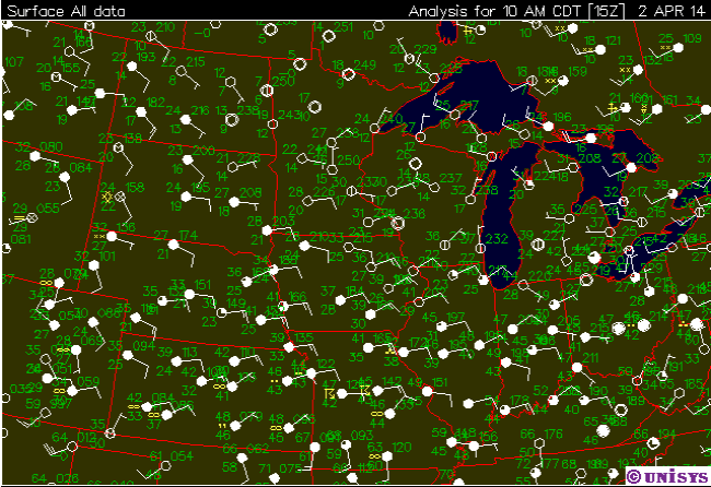
| This map shows the current surface conditions over the Midwest. Cloud cover is persistent to our west and south, though our region is mostly clear. |


No comments:
Post a Comment