Temperature: 35F
Feels Like: 25°F
Wind: West @ 15 mph
Humidity: 57%
Pressure: 1014.1 mb é
Another day of chilly of unseasonably low temperatures in the Chippewa Valley. The day started out as cloudy and windy as we were on the southwestern edge of a low pressure system moving through to our north. The winds picked up and gusting winds were prominent. Misty conditions in the morning and a low dew point depression gave way to snow starting around 12:00 PM. The snow didn't last long, though the overcast skies persisted, finally moving on around 3:00 PM. Winds have predominantly been from the west for most of the day. Highs only reached the mid 30's today and will rise only to the lower 40's for the next few days. The next few days will be full of snow and wintry mix, through Friday.
 |
| This map shows the current pressure systems over the country. We are still currently being affected by the low pressure system to the north, accounting for the westerly winds we have been experiencing all day. A cold front is also moving through over the region, dropping temperatures across the upper Midwest. |
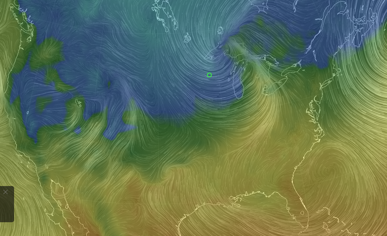 |
| This shows the current wind conditions and temperatures over the country. The southernmost part of the low pressure system to our north is drawing warmer southern air masses north. Unfortunately, they are on the eastern side of the system and not warming us up! |
 |
| The jet is currently taking a southern course, though due to the low pressure system drawing cold air down from central Canada on its eastern side, temperatures remain chilly. |
 |
| This surface map shows current conditions over the Midwest. Winds persist out of the west, as the temperatures on this side of the low pressure system are much colder than those on the east side of the system. |
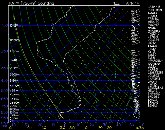 |
| This sounding from Minneapolis, Minnesota shows a very low lower condensation level, while the LI and KI values show no significant atmospheric activity. |
No comments:
Post a Comment