Temperature: 45°F
Feels Like: 40°F
Wind: Southeast @ 9 mph
Humidity: 68%
Pressure: 1006.8 mb ê
A dreary and overcast day in the Chippewa Valley should bring warmer temperatures and rain. The weekend brought progressively warmer temperatures with increasing winds and mostly clear skies. These warmer temperatures are predicted to drop off a little after today, ranging from the upper 30's to the mid 40's for the rest of the work week. We are supposed to get into the upper 50's, close to 60°F. Rain is supposed to roll in mainly before 3:00 PM and then persist, on and off, for the rest of the day, gradually turning into snow overnight.
 |
| This shows a strong low pressure system centered over the Dakotas and southern Minnesota. This midlatitude cyclone will develop the blizzard conditions present over the northern portions of the Dakotas through the upper reaches of Minnesota. |
 |
| This is the storm that will affect a large portion of the Midwest, spanning down to Texas. Through North and South Dakota and northern Minnesota there will be blizzard like conditions. Below this, through eastern South Dakota and the middle of Minnesota will be icy. Everything to the south, including almost all of Wisconsin, will be rain with some thunderstorms. |
 |
| This shows a breakdown of the wind patterns caused by the large midlatitude cyclone. Strong winds, gusting upwards of 40-60 mph will be present near the center of the system, while dust will be blowing out of Kansas. |
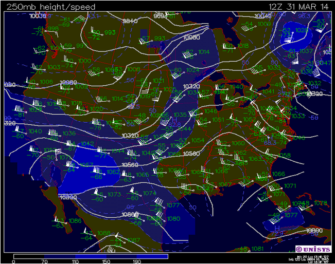 |
| This shows the current patterns of the jet stream over the country. A southern path is helping to alleviate the cold and bring warmer temperatures to the northern reaches of the US. |
 |
| This surface map shows current conditions in the Midwest. The low pressure system, evidenced by counterclockwise swirling winds is currently centered over the eastern trisect of the Nebraska, Kansas, and Iowa borders. Strong winds are seen in the western portion of the system, while winds out of the south are currently affecting the eastern portion of the map. |
 |
| This sounding from Minneapolis, Minnesota shows mild atmospheric activity, indicated by the K-Index value of 23. This indicates that there is a small chance for thunderstorm conditions. |
No comments:
Post a Comment