Temperature: 37°F
Feels Like: 30°F
Wind: Southeast @ 9 mph
Humidity: 93%
Pressure: 1000.3 mb ê
A very overcast, rainy, and dreary day in the area as we see a small break from snow! We are currently experience completely overcast skies, light precipitation in the form of mist, and foggy conditions. These conditions will most likely hang around for the better part of the day and into tomorrow. The temperatures will be hovering around the upper 30's and low 40's. A low pressure system is still strongly affecting the area and is centered over Iowa. The fronts associated with this system are currently stationary over the Iowa-Minnesota area. A warm front is pushing up through Wisconsin right now, allowing for a rise in temperatures, the ability for our precipitation to be rain, and, coupled with a lot of snow melt, the saturation level of the air is very high. The next few days can expect to see a rise in temperatures, peaking on Sunday in the lower 50's.
 |
| This map shows a low pressure trough moving over the central region of the country. This has developed into a stationary front over Iowa and Minnesota, bringing rain showers with it. There is a very large high pressure dome of the east coast by the Carolinas. |
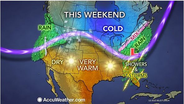 |
| This Accuweather map has changed a little over the last couple days. The jet stream has shifted and the warmer weather is starting to push even further northward. |
 |
| The jet stream is starting to straighten out on its southern extent, allowing for a northward push of warmer air. This is allowing for the temperatures to reach into the 40's and 50's this coming weekend. |
 |
| The surface map shows current conditions over the Midwest. Most of the region is overcast and a large portion of the region is foggy. This is apparent by the 93% relative humidity, which means that the air is very saturated and the LCL can form much lower. |
 |
| This sounding from Minneapolis, Minnesota shows some very mild atmospheric activity. The Lower Condensation Level is very low, which is apparent by fog cover in the area. |
No comments:
Post a Comment